


Table of Contents
Author | Elvira Esparza
Climate resilience is society’s ability to prepare for and adapt to the effects of climate change. To tackle this challenge, cities implement various strategies. One tool that has shown positive results in some cities is digital twins, which enable better planning and management of urban resources to combat climate change.
Digital twins are a key resource for urban planners and designers when planning building construction, taking into account energy efficiency, energy consumption, sustainability, renovation, preventive maintenance, or building systems. The use of digital twins in cities to achieve climate resilience is important because, according to some analyses, digital twins can improve building energy efficiency by 30 to 40%.
What are digital twins?
A digital twin is a digital representation of a physical object that is updated with real-time data and allows for the simulation of different scenarios. An urban digital twin integrates information on mobility, energy consumption, water management, air quality, and IoT sensors. It collects data from vehicles, buildings, infrastructure, networks, and environmental sensors, as well as data provided by the Internet of Things (IoT) and artificial intelligence.
How do cities use digital twins to boost climate resilience?
Cities use digital twins to strengthen resilience against natural disasters, a key element in achieving the Sustainable Development Goal on sustainable cities and communities. This SDG calls for cities and human settlements to be inclusive, safe, resilient, and sustainable.
The use of urban digital twins in city planning is very recent. The first case dates back to 2014 in Singapore, although it was not until 2018 that platforms began to be developed in different cities. Today, according to forecasts from the consulting firm ABI Research, more than 500 cities could be using digital twins.
Most cities use digital twins for:
- Flood modeling and management to identify flood-prone areas and coordinate evacuations.
- Climate scenario simulation to assess the impact of heat waves or rising sea levels on cities.
- Green infrastructure design to mitigate urban heat islands.
- Emergency management to respond in real time.
- Energy grid planning to create more resilient networks.
- Environmental monitoring to detect localized droughts or changes in groundwater levels.
Which cities use digital twin technologies?
Singapore
Singapore is a leading example in the use of digital twins in cities. In 2015, it launched the Virtual Singapore project, which has transformed city planning. The platform is a 3D digital model that integrates all real-time city data to simulate complex urban scenarios and prevent potential incidents affecting infrastructure and services.
The model includes 3D representations of all buildings and infrastructure with full details, as well as real-time data from IoT sensors, artificial intelligence, and big data to simulate different scenarios. It is a national-scale model covering mobility, energy, climate, security, water, emergencies, and the port.
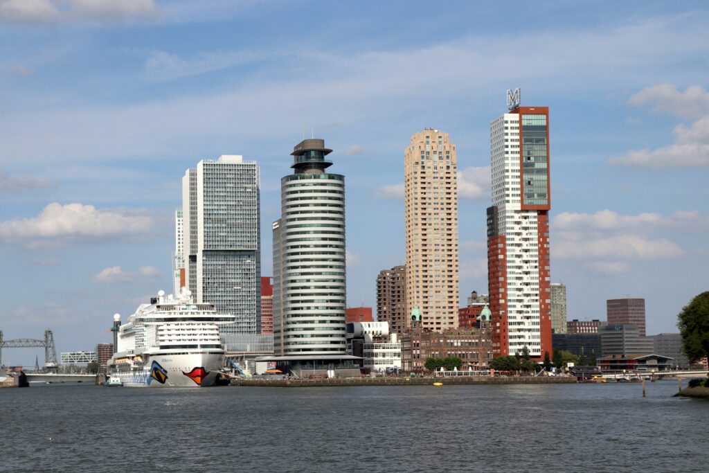
Rotterdam
Rotterdam has developed a full digital twin of the city that models the effects of climate change on urban infrastructure. Using weather data, hydrological models, and information about infrastructure, it simulates flood scenarios and assesses the measures the city should take. It is used for urban planning, flood management, energy transition, and logistics.
Helsinki
Helsinki uses a 3D visual model and a semantic model that integrates technical data on buildings, infrastructure, and the environment. With this tool, the city can simulate climate change scenarios and assess urban energy performance. It is considered an international benchmark for its open and participatory approach. It is used for urban management, innovation, virtual tourism, and climate resilience.
Milan
Milan uses digital twins to monitor and improve air quality and green spaces. It evaluates the effectiveness of different green infrastructure strategies, such as adding green roofs or expanding tree planting to combat heat islands and pollution.
Houston
Houston is one of the U.S. cities that applies digital twins most extensively in the energy sector and critical infrastructure projects. Since the 2010s, it has implemented digital twins in refineries, industrial plants, and power grids, integrating IoT, artificial intelligence, and big data.
These cities have some of the most advanced digital twin projects, but there are also significant initiatives in London, Dubai, Shanghai, Amsterdam, and Barcelona.
Images | Dennis Lamberth, Julia Taubitz


