


Table of Contents
Author | Lucía Burbano
Often, the combination of two smart technologies amplifies their individual capabilities, working together like allies. This synergy is especially evident between devices that collect data and those that process, screen, and analyze it. In the case of LiDAR and artificial intelligence, combining these technologies has multiple applications that improve infrastructure and enhance life in smart cities.
What is LiDAR?
LiDAR, which stands for Light Detection and Ranging or Laser Imaging Detection and Ranging, is a remote sensing technology that measures distances by emitting laser pulses and calculating the time it takes for them to reflect off a surface and return to the sensor. Compared to other measurement systems, LiDAR technology excels at generating highly precise three-dimensional maps, making it invaluable for urban planning.
Before its application in urban planning and smart cities, LiDAR was utilized in other fields. The concept of using the time it takes for a laser to return in order to determine distance, was first proposed by physicist E.H. Synge in 1930. He used reflectors to study the atmosphere and measure cloud heights.
With its short wavelength, laser light enables the precise measurement of even the smallest objects. This is why LiDAR was initially used in land cartography and has become an essential tool in fields such as geology, forestry sciences, and oceanography, as well as in construction and architecture.
In these areas, latest trends show that LiDAR can deliver highly valuable results when combined with the following technologies:
- Drones: Reduces costs and speeds up the collection of urban data.
- Artificial Intelligence: Automates the classification of buildings, vegetation, and urban road networks.
- Digital twins: LiDAR models are integrated with real-time data to support planning, infrastructure management, and climate resilience.
Artificial Intelligence and LiDAR, the perfect combination
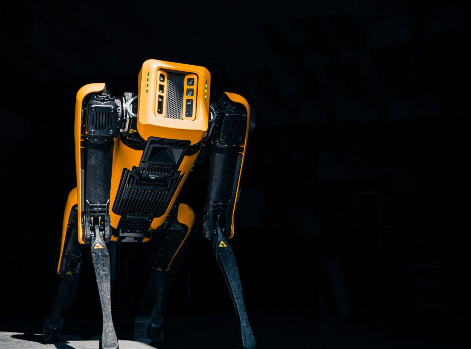
To perform these measurements, LiDAR technology incorporates a series of sensors that generate data, which is then processed and enhanced by Artificial Intelligence (AI). AI algorithms, particularly those utilizing machine learning and deep learning, can process this data to identify patterns, classify objects, and perform predictive analyses with remarkable speed and precision.
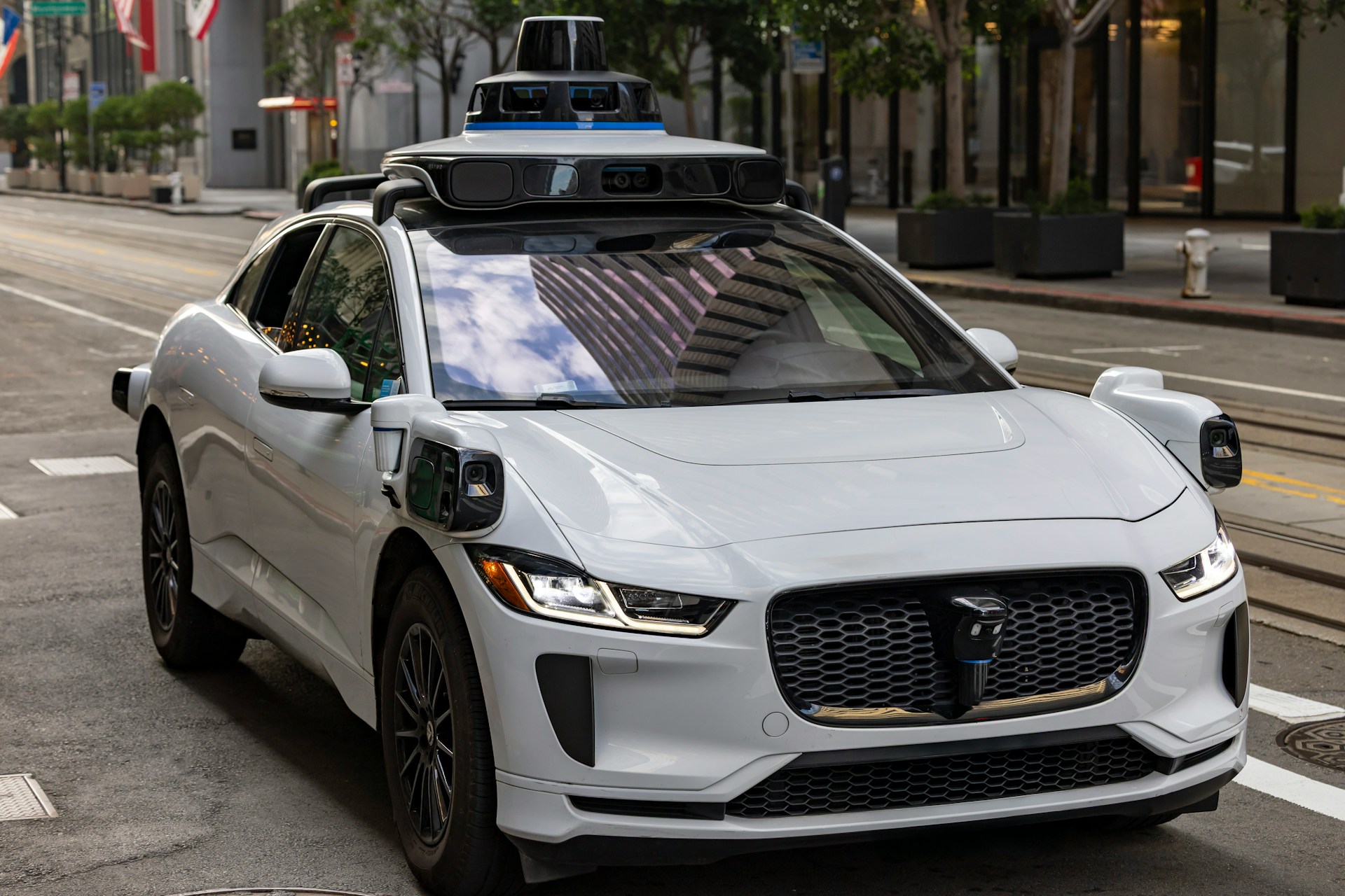
This capability is crucial for LiDAR applications requiring real-time decision-making, such as its integration into self-driving vehicles, where AI leverages LiDAR data to navigate, identify obstacles, detect road boundaries, and monitor other vehicles.
In urban planning and smart cities, the integration of LiDAR and AI enables the creation of detailed 3D city models. These models are instrumental in analyzing various aspects of sustainable planning, such as optimizing traffic flow, assessing population density, and forecasting infrastructure needs.
What are the main applications of LiDAR in urban planning?
In addition to AI, LiDAR is integrated with drones, GIS (Geographic Information Systems), and digital twins, allowing it to be applied across a wide range of urban planning and management functions.
3D city modeling
LiDAR generates highly accurate three-dimensional models of buildings, streets, bridges, and other urban features. These models are invaluable for creating digital twins of cities, planning new urban developments, and simulating urban growth.
Infrastructure design and management
LiDAR data provides highly accurate topographic measurements for civil engineering projects, highways, and transportation networks while significantly reducing surveying time compared with traditional methods.
Reducing flood risk
The terrain data captured by LiDAR enables low-lying areas, flood-prone zones, and vulnerable infrastructure to be identified, supporting more resilient urban planning and the development of emergency response plans.
The Indian city of Varanasi, for example, uses a LiDAR-based digital twin to predict flooding and improve disaster response.
Urban tree management and climate adaptation
LiDAR can measure tree height, vegetation cover, canopy volume, and areas lacking vegetation, helping cities combat urban heat islands and plan reforestation initiatives.
In Laredo, Texas, LiDAR is used to identify neighborhoods with insufficient tree canopy and guide climate resilience strategies.
Evaluating public spaces
LiDAR-generated 3D models can assess accessibility, urban comfort, and landscape quality, helping planners design parks and public spaces that are safer and more functional.
AI-powered LiDAR, mobility, and smart cities
In the field of mobility and smart cities, combining LiDAR with AI enables three-dimensional information about the surrounding environment to be captured and analyzed in real time to improve transportation safety, efficiency, and sustainability.
Some of the most important applications include:
Smart traffic and public transportation management
LiDAR sensors installed at intersections, on poles, or on drones detect and track vehicles, pedestrians, and cyclists without relying on facial recognition or license plate identification. AI analyzes this data to measure traffic flow in real time, identify congestion, and optimize traffic signal timing through adaptive traffic control.
In public transportation, combining LiDAR with AI enables operators to monitor station occupancy, measure wait times, optimize routes and service frequency, and identify bottlenecks at transit terminals.
Supporting autonomous vehicles
LiDAR provides a highly accurate three-dimensional representation of the surrounding environment, while AI interprets this information so autonomous vehicles can identify pedestrians, cyclists, and other vehicles, recognize traffic signs and obstacles, and plan safe routes that minimize the risk of collisions.
Cities utilizing LiDAR and AI: purpose and application
Peachtree Corners, Atlanta
Peachtree Corners, a city in the Atlanta metropolitan area, is using LiDAR technology combined with AI at its busiest intersection, which has five lanes and sees over 60,000 vehicles per day. This intersection also records the city’s highest number of accidents.
The goal is to create real-time 3D mapping to enhance pedestrian safety and optimize traffic flow. The data collected and analyzed enable adjustments to traffic light timings, pedestrian crossing signals, and inform the potential redesign of these intersections.
New York
In New York, LiDAR technology is employed to detect and assess the structural integrity of bridges. By emitting lasers from different angles, engineers can identify small cracks and deformities that might go undetected during routine inspections.
The application of this technology has significantly enhanced the effectiveness and safety of maintaining these structures. The integration of technologies like LiDAR scanning and machine learning improves precision and enables the implementation of predictive maintenance strategies.
Vancouver
Vancouver required LiDAR data covering the entire land surface of the city, including the classification of geographical features, to update topographical maps and assess potential natural risks.
The collection of this data is typically done manually, but AI intervenes by streamlining processes that would otherwise be time-consuming and costly.
Questions and answers about AI-powered LiDAR
What is LiDAR technology?
LiDAR is a remote sensing technology that uses laser pulses to measure distances and generate highly accurate three-dimensional models of the surrounding environment.
How does artificial intelligence improve LiDAR performance?
AI automatically analyzes point clouds, identifies objects, detects patterns, and enables real-time decision making.
What are the benefits of LiDAR for urban planning?
LiDAR supports the creation of 3D city models, infrastructure design, and data-driven planning based on accurate, up-to-date information.
How does LiDAR improve mobility in smart cities?
It enables traffic monitoring, optimizes traffic signal timing, and improves the safety of pedestrians, cyclists, and vehicles through real-time analysis.
How does LiDAR help create more sustainable cities?
It supports urban tree management, flood risk assessment, and the planning of infrastructure that is more resilient to climate change.
Photographs | Unsplash/ThisisEngineering, Unsplash/Mika Baumeister, Unsplash/Leo_Visions


: Innovative Technologies and Strategies for the Cities of Tomorrow")


 in the HORECA Channel")


