Cities around the world coordinate to combat new pandemics: that is how they want to win the battle

A new international project located in Valencia, Spain, seeks to develop common guidelines to stop the pandemic anywhere in the world.
Portugal Smart Nation: the tale of how a nation can become global

Discover how Portugal is leveraging research and innovation to build and deploy smart and sustainable cities globally. This session will explore the key game changers of the Smart Portugal ecosystem. Organized by: AICEP Portugal Global
G20 Global Smart Cities Alliance – Launching the Policy Roadmap

The G20 Global Smart Cities Alliance will launch its ground-breaking global policy roadmap for ethical smart cities ahead of the G20 Summit. If you would like to get involved in the G20 Global Smart Cities Alliance, please visit our website at globalsmartcitiesalliance.org and go to the ‘Get Involved’ section of the website. Organized by: G20 […]
Synergy: Places made human

A unique solution to make Cities and Places more inclusive, efficient and useful. Friendlier. Smarter. Synergy was created with the purpose to make Places Human while boosting efficiency across Cities and Places. Designed to leverage the power of technology to manage a wide variety of infrastructures, namely buildings, transport, logistic hubs and stadiums, Synergy offers […]
Digital society facing a new challenge: Sharing data for the common good

Information shared within digital societies can be a powerful tool to fight COVID-19. But it can also lead to ethical dilemmas.
LMT: Traffic monitoring tools
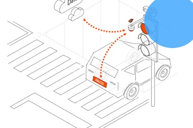
A device to provide smart, efficient, and precise monitoring opportunities. The LMT traffic monitoring tool lets you tackle the most common traffic violations for the best price and without construction. The device contains over 10 different features used to provide smart, efficient, and precise traffic monitoring. The solution makes use of a plug-and-play transport monitoring […]
South Korea develops a blockchain system for autonomous vehicle identification

Blockchain’s potential to improve the traceability of information is being explored in varied and unexpected ways.
AAM Solution: The future of personal mobility is up in the air

A solution for on-demand personal air commuting. ADVANCED AIR MOBILITY (AAM) is a disruptive start-up, established to offer a response to the current and future needs of Urban Air Mobility (UAM). Through an innovative aerodynamic solution, it offers a new concept of sustainable personal air mobility, which facilitates the fast urban and suburban movement of […]
ArcGIS: Building smart communities for good governance, by ESRI

A solution to optimize transparency and citizen participation in local administrations. Esri is the leading provider of Geographic Information Systems (GIS) and ArcGIS, the most implemented platform in the field of Spanish Public Administration. Its Platform allows to approach geographic projects with guarantees and significantly improve decision making. With ArcGIS, clients can manage, analyze, and […]
Motion-S: Smart insights for a better mobility
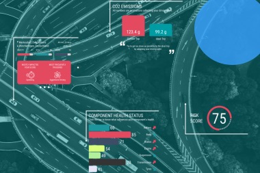
Data-driven mobility analytics for smart cities. Luxembourg-based company Motion-S has developed a platform that gathers and processes large quantities of data. It applies artificial intelligence to find patterns, dependencies, and correlations to predict future events. This platform creates clear and unambiguous reports supporting decision-makers to plan, execute, and manage all activities to optimize mobility. MORE […]