CARLO RATTI: Reinventing the Post-pandemic World

During the last decades, we have experienced several global crises. However, the COVID-19 crisis has had a big impact on a physical level and on the day-to-day functioning of cities. Now, cities are faced with profound challenges regarding the way we work, live and interact. How can cities reinvent themselves for this radically altered world? […]
EVcharge: eMobility made easy

A SaaS platform to better manage electric mobility. A SaaS platform in the cloud designed for the comprehensive management of electric mobility and energy management of your EVcharge network and subnetwork. EVcharge solution MORE INFO Product Information Download document What do we offer? Download document GET IN TOUCH Company Link: evcharge.net E-mail: [email protected] Contact Phone: 34 977 27 […]
Proxyclick: Getting ready for the future of work

An app to seemlessly grant access to employees. From visitors to employees, contractors and beyond, manage people flows your way while staying secure and globally compliant. Proxyclick’s unified visitor and employee flow management Proxyclick’s visitor management system features MORE INFO Proxyclick’s touchless check-in Check out Proxyclick’s Return Ready resource center Check out Proxyclick – visitor […]
OpenCities Planner: Twinning to make sense of the future cities
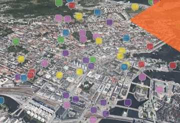
An always-on environment to Improve decisions and planning for smart cities. With OpenCities Planner, you can improve decisions and planning for city operations, urban development, and infrastructure projects. Access your plans and projects anywhere and anytime with a cloud-based environment. Start with the data you have now, and add more when you are ready – […]
Outdoor Smart Parking Solutions: Parking made simple
Sensor-based products to improve parking. Manage spaces efficiently, achieving a much more effective control and greater productivity of the parking areas. The identification and control of the users parked in each space drastically reduces infractions and increases vehicle rotations in these areas, and this impacts favorably on the parking availability. The availability is transmitted to users through […]
Urban Water Management: Making every drop count
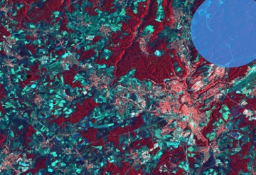
A solution to better water resource management. Using open earth observation data, such as satellite images, WEO will extract and process water resource management information by applying its proprietary deep learning algorithms, employing other modelling tools and validating the outputs with high resolution ground sourced data. Products and services will be available in the form […]
IEE: People Counter

A solution to enhance building security and manage occupancy regulations. Being able to accurately track and record the precise number of people present in buildings or moving through high-traffic areas at any given time is an invaluable asset. An exact count not only allows organizations to optimize their staffing and energy demands, it is also […]
Expo 2020 Dubai: A blueprint for future smart cities

Leveraging the Siemens’ Mindphere IoT platform for the future of urban living. At Expo 2020 Dubai, Siemens is reshaping the future of urban living by creating a blueprint for future smart cities. In this sense, it integrates Siemens technologies across 137 buildings, thus turning the event into the history’s most digitalized, sustainable and secure Expo. […]
Citibeats: Finding the “so what” to solve people’s problems

An analytics platform turning opinions at scale into meaningful data. Citibeats is an augmented text analytics platform that helps private and public organizations understand what matters to people at scale, in real-time, guiding decision-makers to take the most timely and necessary actions. Citibeats makes sense of this data and identifies social facts and trends that […]
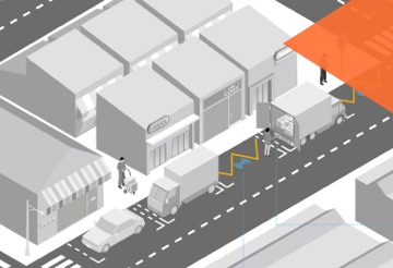
EyeVi: Road Network Intelligence

EyeVi – AI-powered platform for geospatial data production. EyeVi Technologies offers an on-demand mapping technology for capturing and processing high accuracy geodata cost-effectively and fast. EyeVi helps to make road infrastructure management sustainable and cost-effective Through EyeVi’s AI-powered and automated 3D mapping platform, road consultants and asset managers can have a constant overview of the […]